Modern geospatial software for better business workflows

Elevate your business with smart, location-based visualizations, planning, and assessments.

What our customers say

“By leveraging Birdi, we have been able to improve efficiency and reduce costs.”

Shane Braddy
National Quarries General Manager
Boral
"Birdi has been great for us. We increased our asset inspection rate and improved our defectidentification of over 11,000 power poles."

Luke Skinner
Head of Innovation
CitiPower, Powercor & United Energy

Birdi is ideal for

Arrow icon
Centralized place for everything geospatial

Instead of geospatial data being spread across emails, USBs and folders, keep it all in the one centralized Birdi workspace. Visualize data on the map, assess images, request processing, determine progress, generate reports and more.

Arrow icon
Seamless data visualization and processing

Visualize ground-based photography, drone images, videos, 360 degree panoramics, existing geoTIFFs and more in the Map View. Process your data into the outputs you need when you need them, such as:

  • Orthophotos
  • Digital Elevation Models
  • 3D model Point Clouds
  • Contours
  • Textured Mesh
Arrow icon
Reduce compliance risk

With your sites and asset images captured and stored in the one place, easily retrieve historical data and records in seconds to mitigate potential compliance risks.

Arrow icon
Share data and trigger workflows

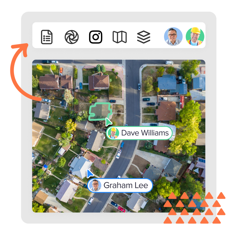
Connect your employees and contractors to seamless workflows based on your geospatial data, with just a few clicks.

Arrow icon
Scalable capture operations

Birdi enables agile businesses to scale their geospatial usage as and when they need it. Upload, store, visualize and process data to match the way your business operates.

Learn more
Birdi for mid to large businesses
Arrow icon
Collaborate easily with your team and contractors

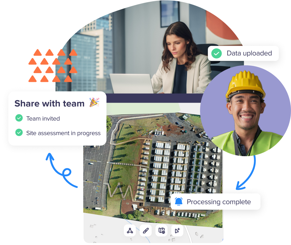
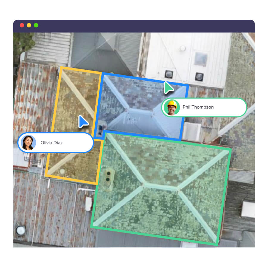
Manage your team members in the one workplace for seamless collaboration. Work together on the same maps and easily share data with anyone who needs it.

Arrow icon
Create 2D and 3D maps and models

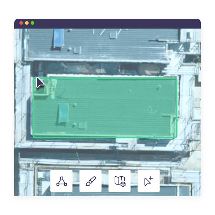
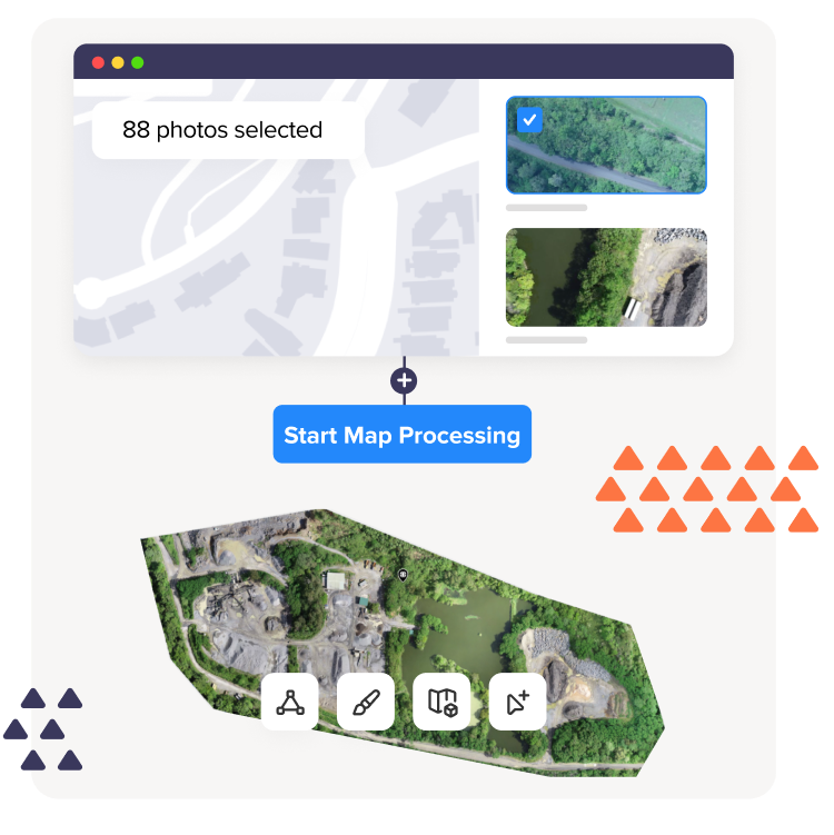
With your data segmented into missions and objectives, you can easily request processing into outputs such as:

  • Orthophotos
  • Digital Elevation Models
  • 3D model Point Clouds
  • Contours
  • Textured Mesh
Arrow icon
Gain actionable business insights

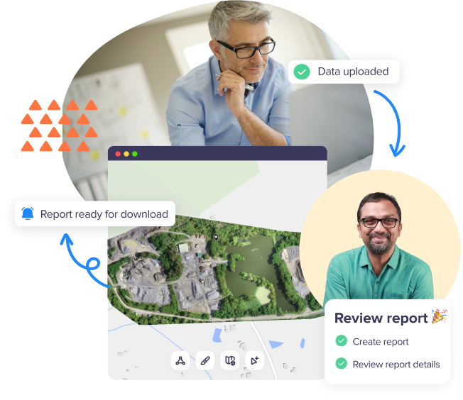
Make informed decisions for improved business operations using up-to-date, actionable data.

Arrow icon
Smoother processes and user experience

Instead of a clunky experience navigating between different systems, improve your team’s processes with everything directly within Birdi.

Birdi for small teams
Arrow icon
Visualize your geospatial data

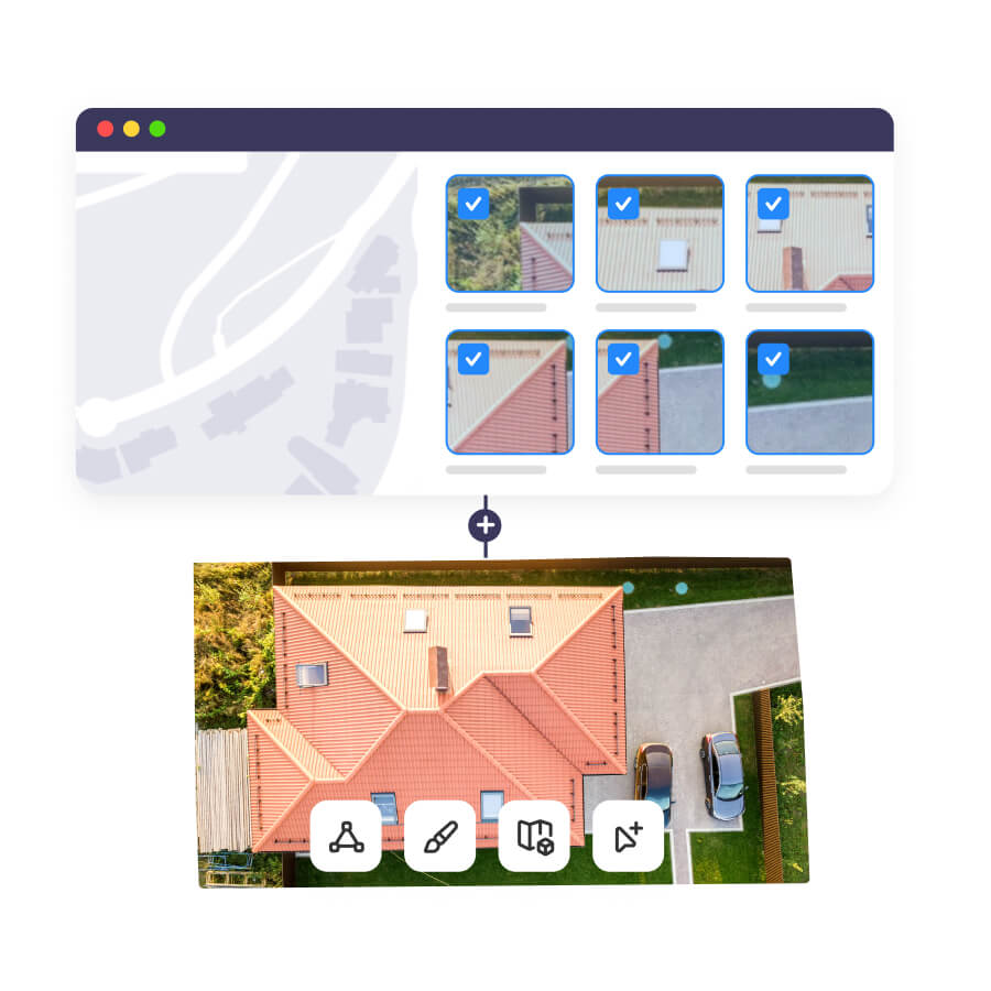
Upload and visualize ground-based photography, drone images, videos, 360 degree panoramics, existing geoTIFFs and more.

Arrow icon
Get your business up and running, minus the expense

Our Plus plan is ideal for businesses who are starting out or in early growth. Save money by paying for processing only when you need it, and not in the months that you don’t.

Arrow icon
Request the outputs you need, when you need them

With PAYG processing, you can request and visualize outputs such as:

  • Orthophotos
  • Digital Elevation Models
  • 3D model Point Clouds
  • Contours
  • Textured Mesh
Arrow icon
Brand your workspace for a professional client experience

Add that extra professional touch to your workspace by uploading your own logo, or creating separate branded workspaces for each of your clients.

Birdi for SMEs and Individuals

The easiest geospatial software you’ll use

Upload. Visualize. Annotate. Collaborate. Report. Share.
Upload
Upload data of your locations and assets, or view our base maps.
Visualize
Visualize your data & generate 2D and 3D maps and models.
Annotate
Utilize our suite of map tools to communicate points of interest, annotate & assess.
Collaborate
Trigger work orders and collaborate in real time.
Report
Generate insights and create reports to suit your business needs.
Share
Share your maps and insights with your team and stakeholders.

One place for all your geospatial data

Forget trawling through emails, USBs and folders. With Birdi, centralize all your geospatial data, processed 2D and 3D maps, reports and insights in the one Birdi workspace.

Sun conure arrow right
One place to manage your geospatial data
Visualize any geospatial data set in Birdi

Visualize any data set

Whatever georeferenced data set you have, you can upload and visualize it in Birdi. Upload ground-based photography, videos, 360 degree panoramics, existing geoTIFFs and more and visualize them in Map View at their precise location.

Canary arrow left

Create 2D & 3D maps and models

Generate a range of maps and models to suit your business needs, such as:

  • Orthophotos
  • Digital Elevation Models
  • 3D model Point Clouds
  • Contours
  • Textured Mesh
Ocean arrow right
Create 2D and 3D maps and models in Birdi
Actionable insights and reporting in Birdi

Get actionable insights and reporting

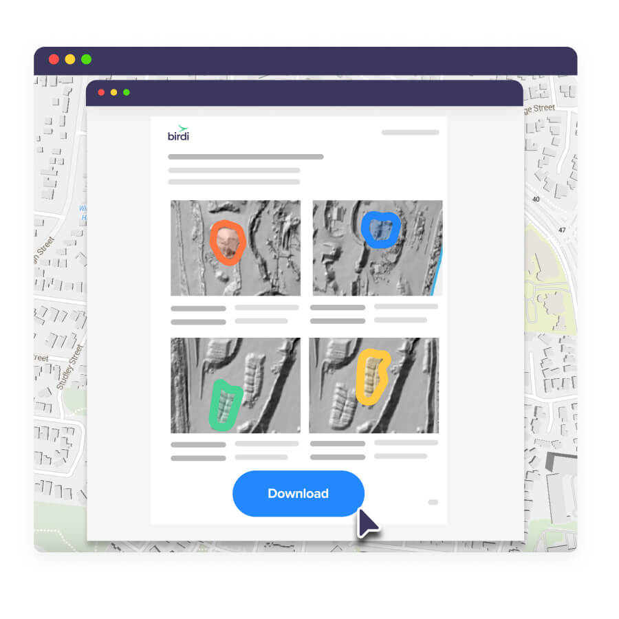
With Birdi, generate a range of reports that can give your company the insights it needs for enhanced decision making.

Fora arrow left

Collaborate and share with your team and stakeholders

Work with your team directly on visualized data and make decisions together.

Midnight arrow right
Collaborate and share maps with Birdi

All the geospatial features you need

Green tick icon
Visualize any data set
Green tick icon
Volumetric reports
Green tick icon
2D and 3D map processing
Green tick icon
RTK processing
Green tick icon
Annotation tools
Green tick icon
Asset assessment
Green tick icon
3D model viewer
Green tick icon
3D model viewer
Green tick icon
Collaboration tools
Green tick icon
Annotation reports
Green tick icon
Difference grids
Green tick icon
Progress reporting
Birdi customer service is next level

We’re with you every step

Birdi customer service is market leading - we treat you like a partner, not a user. Gone are the days you need to trawl through help docs alone or wait days for an email response. We’re right there on chat!